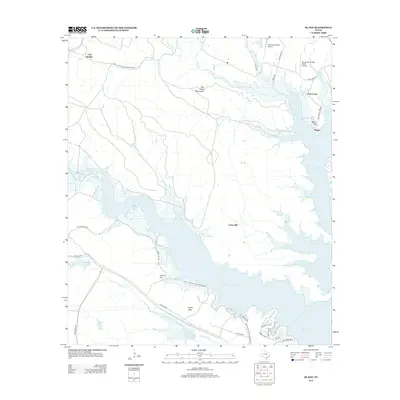
2012 Map of Bland
USGS Topo · Published 2012About this map
The Fort Hood Military Reservation dominates the southwestern and northern reaches of this landscape, framing a region defined by the expansive waters of Belton Lake. This 2012 survey illustrates how the reservoir's fingers reach deep into the terrain, creating complex shorelines along Bull Br and Taylor Br. In the center of the sheet, the settlement of Union Hill sits on higher ground, while the eastern shore is marked by the community of Bland and the nearby Bland Mtn. The map records a mix of federal military land and private ranching interests, evidenced by the Woody Mc Clellan Ranch Airport and The Grove/Ranch Airport. Elevations vary from the low-lying Nolan Lake to the prominent Owl Creek Mountains, showcasing the transition from aquatic environments to the rugged uplands of Liberty Hill and Sparta Mtn.
Find a feature on this map
37 named features on this map. Tap any name to fly to it.
Don’t see what you’re looking for? This feature index may not catch every label — zoom into the map to look around manually.
Map Details
Editions of this 2012 Bland Map
This is the sole edition of this map. No revisions or reprints were ever made.
Other maps of this area

1892 · Temple
USGS Topo · 1:125,000

1894 · Gatesville
USGS Topo · 1:125,000

1924 · Gatesville 4-d
USGS Topo · 1:48,000

1924 · Gatesville 4-a
USGS Topo · 1:48,000

1924 · Temple 2-C
USGS Topo · 1:48,000

1924 · Temple 3-C
USGS Topo · 1:48,000

1924 · Temple 3-B
USGS Topo · 1:48,000

1930 · Killeen
USGS Topo · 1:62,500

1931 · Mc Gregor
USGS Topo · 1:62,500

1931 · Belton
USGS Topo · 1:62,500