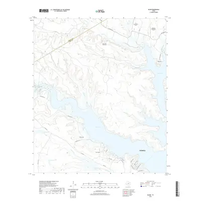
2019 Map of Bland
USGS Topo · Published 2019About this map
Belton Lake dominates the central landscape of this Bell County region, its winding fingers filling the deep valleys between the Owl Creek Mountains and prominent elevations like Bland Mtn and Sparta Mtn. Near the northern shore, the Owl Creek Mountains rise sharply above Owl Cr, while the southern reaches of the map show the edge of Temple and the residential layout of Liberty Hill. This 2019 survey documents a landscape of modern ranching and outdoor recreation, featuring private airstrips such as The Grove/Ranch Airport and Woody Mc Clellan Ranch Airport. The topography reveals the complex hydrology of the Edwards Plateau transition, where creeks like N Nolan Cr and Taylor Br feed into the reservoir, shaped by the local high points of Denmans Bluff and Sparta Mtn.
Find a feature on this map
37 named features on this map. Tap any name to fly to it.
Don’t see what you’re looking for? This feature index may not catch every label — zoom into the map to look around manually.
Map Details
Editions of this 2019 Bland Map
This is the sole edition of this map. No revisions or reprints were ever made.
Other maps of this area

1892 · Temple
USGS Topo · 1:125,000

1894 · Gatesville
USGS Topo · 1:125,000

1924 · Gatesville 4-d
USGS Topo · 1:48,000

1924 · Gatesville 4-a
USGS Topo · 1:48,000

1924 · Temple 2-C
USGS Topo · 1:48,000

1924 · Temple 3-C
USGS Topo · 1:48,000

1924 · Temple 3-B
USGS Topo · 1:48,000

1930 · Killeen
USGS Topo · 1:62,500

1931 · Mc Gregor
USGS Topo · 1:62,500

1931 · Belton
USGS Topo · 1:62,500