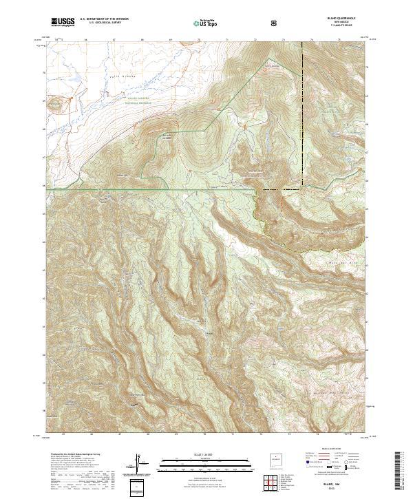
2023 Map of Bland
USGS Topo · Published 2023About this map
Valle Grande dominates the northwest corner of this terrain, marking the edge of the Valles Caldera National Preserve. This mountainous landscape in Sandoval County reveals a complex system of volcanic mesas and deep-cut canyons, including Cochiti Mesa and Upper Horn Mesa. The map traces the historical footprints of the settlement at Bland, situated at the convergence of Medio Dia Canyon and Bland Canyon, reflecting the area's legacy of high-altitude habitation and mining. The terrain is defined by dramatic elevation shifts, with peaks like Cerro Grande rising above the surrounding Bandelier National Monument and the San Miguel Mountains. A network of water sources such as Alamo Spring and Sawyer Spring feed into the East Fork Jemez River, providing vital points of reference in a landscape characterized by its volcanic geology and managed wilderness areas.
Find a feature on this map
68 named features on this map. Tap any name to fly to it.
Don’t see what you’re looking for? This feature index may not catch every label — zoom into the map to look around manually.
Map Details
Editions of this 2023 Bland Map
This is the sole edition of this map. No revisions or reprints were ever made.
Other maps of this area

1890 · Jemes
USGS Topo · 1:125,000

1892 · Jemes
USGS Topo · 1:125,000

1892 · Santa Clara
USGS Topo · 1:125,000

1937 · Jemez Springs
USGS Topo · 1:48,000

1943 · Jemez
USGS Topo · 1:62,500

1944 · Jemez Springs
USGS Topo · 1:62,500

1952 · Valle Toledo
USGS Topo · 1:24,000

1952 · Jemez Springs
USGS Topo · 1:62,500

1952 · Frijoles
USGS Topo · 1:24,000

1952 · Guaje Mountain
USGS Topo · 1:24,000