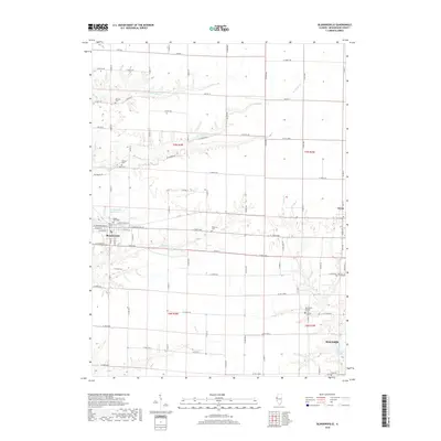
2018 Map of Blandinsville
USGS Topo · Published 2018About this map
Blandinsville serves as the primary hub of this McDonough County landscape, centered on a grid of historic streets like E Washington St and W Fillmore St. The surrounding countryside is defined by the headwaters and tributaries of several prominent waterways, including the S Br La Moine River, La Harpe Cr, and Baptist Cr. This 2018 survey reveals a high density of small family and community burial grounds scattered across the township lines, such as Mustain Cem and Liberty Cem. The local water infrastructure is anchored by the Blandinsville City Reservoir to the north and the northern reaches of Spring Lake near Macomb in the southeast corner. To the east, the village of Sciota sits along the quadrangle boundary, connected to the hinterlands by an extensive network of rural roads like Blackburn Rd and N 2000th Rd.
Find a feature on this map
58 named features on this map. Tap any name to fly to it.
Don’t see what you’re looking for? This feature index may not catch every label — zoom into the map to look around manually.
Map Details
Editions of this 2018 Blandinsville Map
This is the sole edition of this map. No revisions or reprints were ever made.
Other maps of this area

1912 · Macomb
USGS Topo · 1:62,500

1913 · Colchester
USGS Topo · 1:62,500

1914 · Macomb
USGS Topo · 1:62,500

1916 · Good Hope
USGS Topo · 1:62,500

1918 · La Harpe
USGS Topo · 1:62,500

1918 · Good Hope
USGS Topo · 1:62,500

1958 · Burlington
USGS Topo · 1:250,000

1961 · Burlington
USGS Topo · 1:250,000

1963 · Burlington
USGS Topo · 1:250,000
1974 · Macomb
USGS Topo · 1:24,000