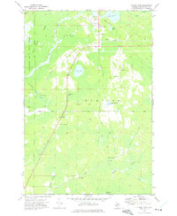
1972 Map of Blaney Park
USGS Topo · Published 1975About this map
The resort and timber landscape of Mueller Township centers on Blaney Park, showing the community's unique development during the early 1970s. The area is characterized by a mix of recreational and industrial use, featuring the Blaney Park Airport and a local Golf Course alongside several gravel pits and the Calspar Quarry. Local religious and social life is anchored by Maple Grove Ch and the Divine Infant of Prague Ch, which sit along the main north-south road corridor.
Find a feature on this map
31 named features on this map. Tap any name to fly to it.
Don’t see what you’re looking for? This feature index may not catch every label — zoom into the map to look around manually.
Map Details
Editions of this 1972 Blaney Park Map
This is the sole edition of this map. No revisions or reprints were ever made.
Other maps of this area

1931 · Manistique River NE
USGS Topo · 1:31,680

1931 · Seul Choix Point NE
USGS Topo · 1:31,680

1931 · Seul Choix Point NW
USGS Topo · 1:31,680

1931 · Manistique River SE
USGS Topo · 1:31,680

1931 · Blaney SW
USGS Topo · 1:31,680

1931 · Blaney NE
USGS Topo · 1:31,680

1931 · Blaney SE
USGS Topo · 1:31,680

1931 · Blaney NW
USGS Topo · 1:31,680

1954 · Escanaba
USGS Topo · 1:250,000

1954 · Sault Sainte Marie
USGS Topo · 1:250,000