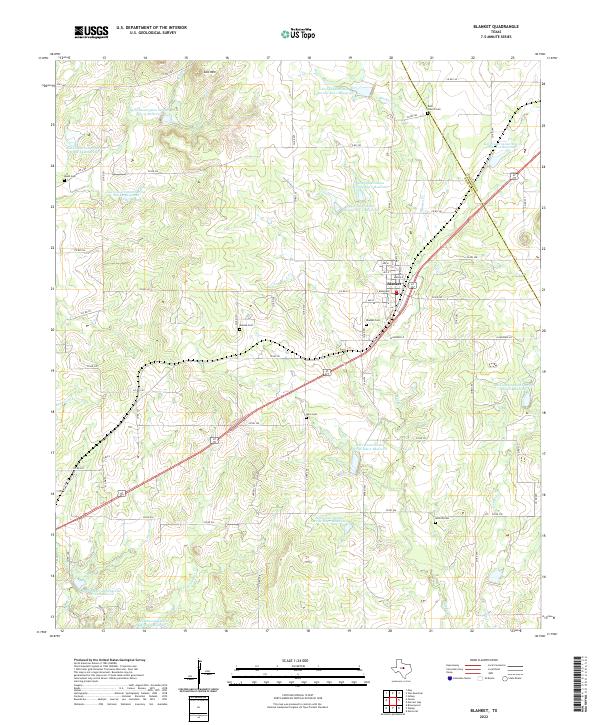
2022 Map of Blanket
USGS Topo · Published 2022About this map
Blanket serves as the primary hub of this Central Texas landscape, situated along the border of Brown and Comanche counties. The town is flanked by a significant network of water management features, including numerous Soil Conservation Service reservoirs such as Soil Conservation Service Site 1 Reservoir and Soil Conservation Service Site 4 Reservoir, which punctuate the drainages of Blanket Cr and Salt Cr. The area is notably rich in rural history markers, with a high density of family and community burial grounds including Rock Church Cem, Blanket Cem, and Antioch Cem scattered across the countryside.
Find a feature on this map
73 named features on this map. Tap any name to fly to it.
Don’t see what you’re looking for? This feature index may not catch every label — zoom into the map to look around manually.
Map Details
Editions of this 2022 Blanket Map
This is the sole edition of this map. No revisions or reprints were ever made.
Other maps of this area

1889 · Brownwood
USGS Topo · 1:125,000

1894 · Brownwood
USGS Topo · 1:125,000

1925 · Brownwood 3-b
USGS Topo · 1:48,000

1928 · Zephyr
USGS Topo · 1:62,500

1931 · Mullin
USGS Topo · 1:62,500

1950 · Zephyr
USGS Topo · 1:62,500

1950 · Mullin
USGS Topo · 1:62,500

1954 · Brownwood
USGS Topo · 1:250,000
1966 · Owens
USGS Topo · 1:24,000
1966 · May
USGS Topo · 1:24,000