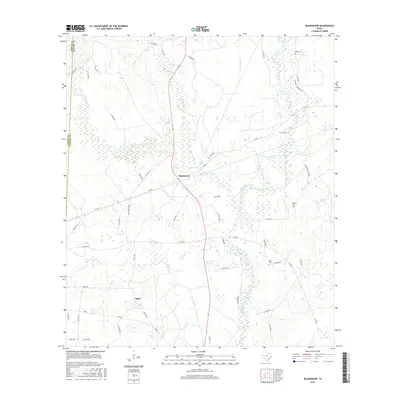
2016 Map of Bleakwood
USGS Topo · Published 2016About this map
White Oak Creek and the meandering waters of Big Cow Creek define this section of the East Texas piney woods along the Jasper and Newton county line. The small settlement of Bleakwood sits at the junction of State Highway 87 and F-M 363, while the community of Adsul lies to the southwest along FM 82. The landscape is notably dominated by expansive wetlands and family-named landmarks, reflecting a history of timber and rural life.
Find a feature on this map
61 named features on this map. Tap any name to fly to it.
Don’t see what you’re looking for? This feature index may not catch every label — zoom into the map to look around manually.
Map Details
Editions of this 2016 Bleakwood Map
This is the sole edition of this map. No revisions or reprints were ever made.
Other maps of this area

1935 · Wilson Lake
USGS Topo · 1:31,680

1947 · Wilson Lake
USGS Topo · 1:31,680

1949 · Bancroft
USGS Topo · 1:31,680

1952 · Lake Charles
USGS Topo · 1:250,000

1954 · Lake Charles
USGS Topo · 1:250,000

1955 · Roganville
USGS Topo · 1:62,500

1958 · Kirbyville
USGS Topo · 1:62,500
1959 · Merryville
USGS Topo · 1:62,500
1959 · Bon Wier
USGS Topo · 1:62,500
1982 · Bancroft
USGS Topo · 1:24,000