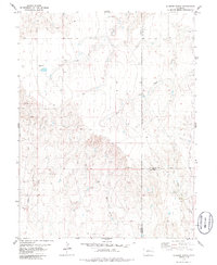
1979 Map of Bledsoe Ranch
USGS Topo · Published 1986About this map
Bledsoe Ranch anchors this high plains landscape at the intersection of Lincoln, Kit Carson, and Cheyenne counties. Mapped in the mid-1970s, the terrain is defined by an intricate network of ephemeral drainages, including Folger Gulch, Adobe Gulch, and Alaya Gulch, which carve through the plateau toward Wild Horse Creek and Sand Creek. The settlement of Overland sits centrally, positioned amidst a sparse scattering of infrastructure like the local Radio Tower and a Gravel Pit. The map captures the vital role of water management in this arid environment, evidenced by numerous Tank sites and a Well providing life to the surrounding rangeland. This survey offers a clear look at the large-scale ranching operations and remote road networks connecting to distant towns like Arriba and Wild Horse.
Find a feature on this map
18 named features on this map. Tap any name to fly to it.
Don’t see what you’re looking for? This feature index may not catch every label — zoom into the map to look around manually.
Map Details
Editions of this 1979 Bledsoe Ranch Map
2 editions found
Other maps of this area

1891 · Arroyo
USGS Topo · 1:125,000

1893 · Arroyo
USGS Topo · 1:125,000

1954 · Limon
USGS Topo · 1:250,000

1954 · Lamar
USGS Topo · 1:250,000

1957 · Limon
USGS Topo · 1:250,000

1958 · Limon
USGS Topo · 1:250,000

1958 · Lamar
USGS Topo · 1:250,000

1978 · Sanders Ranch
USGS Topo · 1:24,000
1978 · Boyero
USGS Topo · 1:24,000

1978 · Clifford
USGS Topo · 1:24,000