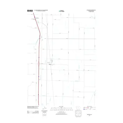
2013 Map of Blencoe
USGS Topo · Published 2013About this map
Blencoe serves as the central hub of this agricultural landscape in Monona County, where the grid-iron street pattern of the town meets the extensive hydraulic engineering of the Missouri River floodplain. The area is defined by a sophisticated network of drainage infrastructure, including the Fletcher Ditch, Sherman Ditch, and McCandless Cleghorn Outlet, which manage the low-lying terrain to support the region's productive farmland. To the north, Guard Lake remains as a remnant of the river's historical path, situated near the Onawa North Bound Rest Area and its southbound counterpart. The map details the transition from town streets like N Manley St and Glenn St to a vast system of county roads and avenues named for local flora, such as Hemlock Ave and Hickory Ave, illustrating the intersection of modern transit and rural life in western Iowa.
Find a feature on this map
50 named features on this map. Tap any name to fly to it.
Don’t see what you’re looking for? This feature index may not catch every label — zoom into the map to look around manually.
Map Details
Editions of this 2013 Blencoe Map
This is the sole edition of this map. No revisions or reprints were ever made.
Other maps of this area

1954 · Omaha
USGS Topo · 1:250,000

1954 · Fort Dodge
USGS Topo · 1:250,000

1955 · Sioux City
USGS Topo · 1:250,000

1955 · Fremont
USGS Topo · 1:250,000

1957 · Fremont
USGS Topo · 1:250,000

1957 · Omaha
USGS Topo · 1:250,000

1957 · Fort Dodge
USGS Topo · 1:250,000

1958 · Sioux City
USGS Topo · 1:250,000

1958 · Omaha
USGS Topo · 1:250,000

1958 · Fremont
USGS Topo · 1:250,000