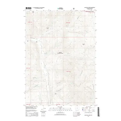
2015 Map of Blind Bull Creek
USGS Topo · Published 2015About this map
Deadman Peak and Cabin Creek Peak anchor the high terrain of the Wyoming Range in this section of Lincoln County. The landscape is defined by the convergence of the Bridger National Forest and Teton National Forest, where the Greys River carves a path through the valley floor. Greys River Rd follows the waterway, providing access to a series of drainage systems including Little Blind Bull Cr and Blind Bull Cr. Local landmarks such as The Elbow, Moose Flat, and Telephone Hollow suggest the historical and geographic markers used by foresters and early travelers. The southern portion of the map is dominated by Black Canyon and the Black Canyon-Blind Bull corridor, illustrating the complex verticality of the Moffat Creek watershed.
Find a feature on this map
32 named features on this map. Tap any name to fly to it.
Don’t see what you’re looking for? This feature index may not catch every label — zoom into the map to look around manually.
Map Details
Editions of this 2015 Blind Bull Creek Map
This is the sole edition of this map. No revisions or reprints were ever made.
Other maps of this area

1921 · Afton
USGS Topo · 1:125,000

1931 · Jackson
USGS Topo · 1:125,000

1935 · Jackson
USGS Topo · 1:125,000

1955 · Driggs
USGS Topo · 1:250,000

1955 · Preston
USGS Topo · 1:250,000

1958 · Driggs
USGS Topo · 1:250,000

1958 · Preston
USGS Topo · 1:250,000

1962 · Driggs
USGS Topo · 1:250,000

1962 · Preston
USGS Topo · 1:250,000

1965 · Pickle Pass
USGS Topo · 1:24,000