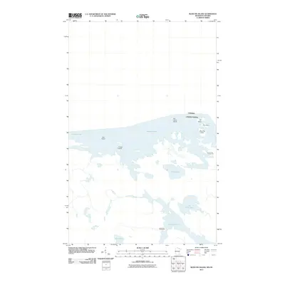
2011 Map of Blind Pig Island
USGS Topo · Published 2011About this map
Namakan Lake and Sand Point Lake dominate this borderland topography, where the international boundary between the United States and Canada cuts across open water and rocky outcroppings. This 2011 survey illustrates the intricate island network typical of the Rainy River District, featuring interestingly named landforms such as Blind Pig Island, My Island, and Your Island. The landscape is defined by its lack of roads and traditional settlements, emphasizing a wilderness character maintained through remote access points like Hammer Bay Campground and Browns Bay Campground. Inland water bodies such as Little Trout Lake and O'Leary Lake further segment the terrain, while larger islands like Pike Island and Juniper Island serve as primary landmarks for navigation through these interconnected waterways.
Find a feature on this map
14 named features on this map. Tap any name to fly to it.
Don’t see what you’re looking for? This feature index may not catch every label — zoom into the map to look around manually.
Map Details
Editions of this 2011 Blind Pig Island Map
This is the sole edition of this map. No revisions or reprints were ever made.
Other maps of this area

1954 · International Falls
USGS Topo · 1:250,000

1957 · International Falls
USGS Topo · 1:250,000

1958 · International Falls
USGS Topo · 1:250,000

1963 · Redhorse Bay
USGS Topo · 1:24,000

1963 · Crane Lake
USGS Topo · 1:24,000

1967 · Namakan Island
USGS Topo · 1:24,000

1967 · Marion Lake
USGS Topo · 1:24,000

1967 · Hale Bay
USGS Topo · 1:24,000
1967 · Kettle Falls
USGS Topo · 1:24,000

1967 · Johnson Lake
USGS Topo · 1:24,000