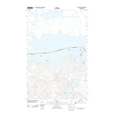
2013 Map of Blind Pig Island
USGS Topo · Published 2013About this map
Namakan Lake and Sand Point Lake dominate this borderland topography, where the international boundary between Canada and the United States threads through a labyrinth of named islands and inlets. In the early 21st century, this section of St. Louis County, Minnesota, remains characterized by its remote water-access geography. Notable features like Blind Pig Island, Pat Smith Island, and the playfully named My Island and Your Island dot the expanse of Namakan Lake. On the Minnesota side, the map documents recreational infrastructure such as Hammer Bay Campground and Browns Bay Campground. The interior landscape is defined by smaller, high-elevation bodies of water including O'Leary Lake, Little Trout Lake, and Lucille Lake, reachable only by navigating the complex terrain of Juniper Island and the surrounding shorelines.
Find a feature on this map
15 named features on this map. Tap any name to fly to it.
Don’t see what you’re looking for? This feature index may not catch every label — zoom into the map to look around manually.
Map Details
Editions of this 2013 Blind Pig Island Map
This is the sole edition of this map. No revisions or reprints were ever made.
Other maps of this area

1954 · International Falls
USGS Topo · 1:250,000

1957 · International Falls
USGS Topo · 1:250,000

1958 · International Falls
USGS Topo · 1:250,000

1963 · Redhorse Bay
USGS Topo · 1:24,000

1963 · Crane Lake
USGS Topo · 1:24,000

1967 · Namakan Island
USGS Topo · 1:24,000

1967 · Marion Lake
USGS Topo · 1:24,000

1967 · Hale Bay
USGS Topo · 1:24,000
1967 · Kettle Falls
USGS Topo · 1:24,000

1967 · Johnson Lake
USGS Topo · 1:24,000