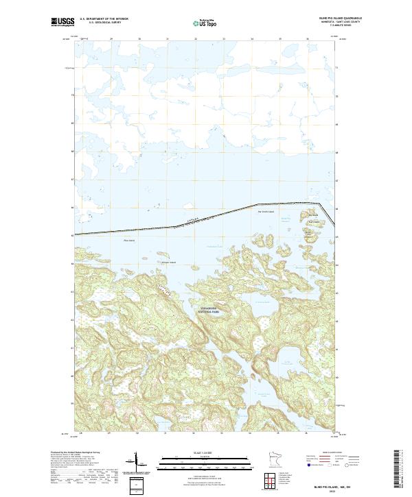
2022 Map of Blind Pig Island
USGS Topo · Published 2022About this map
Voyageurs National Park encompasses the southern portion of this map, showcasing a complex aquatic landscape along the international border. The territory is defined by the winding waters of Namakan Lake and Sand Point Lake, where numerous small landforms such as Blind Pig Island, Pat Smith Island, and Pike Island break the surface. The intricate shoreline is marked by sheltered reaches like Hammer Bay, Browns Bay, and Grassy Bay, illustrating the fragmented nature of this northern wilderness before it transitions into more consolidated landmasses to the south. This area serves as a primary corridor for water-based navigation through the Blind Pig Channel and into interior bodies like Little Trout Lake and Lucille Lake. The survey also documents the precise line of the Canada United States of America border as it cuts through the open water of the northern lakes.
Find a feature on this map
22 named features on this map. Tap any name to fly to it.
Don’t see what you’re looking for? This feature index may not catch every label — zoom into the map to look around manually.
Map Details
Editions of this 2022 Blind Pig Island Map
This is the sole edition of this map. No revisions or reprints were ever made.
Other maps of this area

1954 · International Falls
USGS Topo · 1:250,000

1957 · International Falls
USGS Topo · 1:250,000

1958 · International Falls
USGS Topo · 1:250,000

1963 · Redhorse Bay
USGS Topo · 1:24,000

1963 · Crane Lake
USGS Topo · 1:24,000

1967 · Namakan Island
USGS Topo · 1:24,000

1967 · Marion Lake
USGS Topo · 1:24,000

1967 · Hale Bay
USGS Topo · 1:24,000
1967 · Kettle Falls
USGS Topo · 1:24,000

1967 · Johnson Lake
USGS Topo · 1:24,000