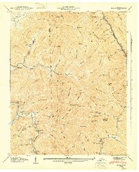
1946 Map of Block
USGS Topo · Published 1947About this map
The Southern railroad line carves through the narrow valleys of this portion of Campbell and Scott Counties, connecting industrial outposts like Turley and Block in the rugged terrain. The 1940s landscape is defined by its ridge-and-valley topography, where small settlements such as Smoky Junction and Montgomery are concentrated along watercourses like Straight Fork and the McKinney Fork. A series of steep inclines and gaps, including Muse Gap and Flint Gap, reveal the logistical challenges of the era's rail-dependent economy. Cultural life is anchored by local institutions such as Antioch Ch and the Round Rock Sch. The map preserves a network of named spurs and ridges, from Massengale Mountain to Log Mountain, reflecting a period when small-scale mining and timber activities left distinct marks on the Cumberland Plateau.
Find a feature on this map
112 named features on this map. Tap any name to fly to it.
Don’t see what you’re looking for? This feature index may not catch every label — zoom into the map to look around manually.
Map Details
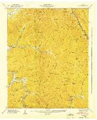
Editions of this 1946 Block Map
2 editions found
Other maps of this area

1893 · Briceville
USGS Topo · 1:125,000

1895 · Briceville
USGS Topo · 1:125,000

1896 · Briceville
USGS Topo · 1:125,000

1936 · Hogbell Gap
USGS Topo · 1:24,000

1936 · Ivydell
USGS Topo · 1:24,000

1936 · Block
USGS Topo · 1:24,000

1936 · Jacksboro
USGS Topo · 1:24,000

1936 · Pioneer
USGS Topo · 1:24,000

1936 · Duncan Flats
USGS Topo · 1:24,000

1936 · La Follette
USGS Topo · 1:48,000