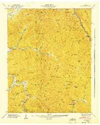
1946 Map of Block
USGS Topo · Published 1947About this map
The Cumberland Plateau landscape of Campbell and Scott counties reveals an intensive industrial imprint in the years following World War II. The Southern railroad line follows the narrow corridor of Cove Creek, serving coal-loading points like Block and Turley. This rugged terrain is defined by steep ridges such as Gray Mountain and Adkins Mountain, where numerous steep Incline tracks are marked, suggesting the gravity-defying transportation once required for timber or coal extraction from high-elevation mines.
Find a feature on this map
102 named features on this map. Tap any name to fly to it.
Don’t see what you’re looking for? This feature index may not catch every label — zoom into the map to look around manually.
Map Details
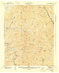
Editions of this 1946 Block Map
2 editions found
Other maps of this area

1893 · Briceville
USGS Topo · 1:125,000

1895 · Briceville
USGS Topo · 1:125,000

1896 · Briceville
USGS Topo · 1:125,000

1936 · Hogbell Gap
USGS Topo · 1:24,000

1936 · Ivydell
USGS Topo · 1:24,000

1936 · Block
USGS Topo · 1:24,000

1936 · Jacksboro
USGS Topo · 1:24,000

1936 · Pioneer
USGS Topo · 1:24,000

1936 · Duncan Flats
USGS Topo · 1:24,000

1936 · La Follette
USGS Topo · 1:48,000