
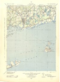
1942 Map of Block Island
USGS Topo · Published 1943About this map
Westerly and Stonington anchor a maritime landscape at the mouth of the Pawcatuck River during the early 1940s. This survey by the Corps of Engineers details the strategic coastal corridor where the NY NH & H RR connects vital textile and manufacturing centers like Carolina, Shannock, and Kenyon. The inland terrain is characterized by complex wetland systems such as Assekonk Swamp and Indian Cedar Swamp, while the coast is a series of interconnected salt ponds including Ninigret Pond and Watchaug Pond.
Find a feature on this map
137 named features on this map. Tap any name to fly to it.
Don’t see what you’re looking for? This feature index may not catch every label — zoom into the map to look around manually.
Map Details
Editions of this 1942 Block Island Map
2 editions found
Other maps of this area

1889 · Stonington
USGS Topo · 1:62,500

1889 · Charlestown
USGS Topo · 1:62,500

1889 · Newport
USGS Topo · 1:62,500

1889 · Block Island
USGS Topo · 1:62,500

1889 · Moosup
USGS Topo · 1:62,500

1890 · Narragansett Bay
USGS Topo · 1:62,500

1890 · Kent
USGS Topo · 1:62,500

1892 · Narragansett Bay
USGS Topo · 1:62,500

1892 · New London
USGS Topo · 1:62,500

1892 · Norwich
USGS Topo · 1:62,500