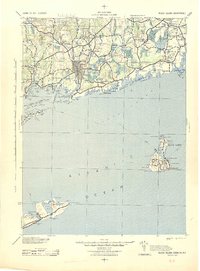
1942 Map of Block Island
USGS Topo · Published 1944About this map
The coastal borderlands of Rhode Island and Connecticut are captured here during the early 1940s, highlighting the strategic maritime importance of the Sound and the Atlantic Ocean. The landscape is dominated by the Pawcatuck River which separates Westerly, Rhode Island, from Stonington, Connecticut. Inland, the industrial and agricultural heritage of the region is evident in the cluster of small settlements along the New York New Haven and Hartford RR, including Shannock, Kenyon, and Carolina. A unique geological feature, Lantern Hill, stands near the Silex Mine, while the southern reaches of the map document the critical navigation aids of the era. The detailed rendering of Block Island and Montauk Point includes several Life Saving Stations, such as New Shoreham LSS and Ditch Plain LSS, alongside historic beacons like the Block Island LH.
Find a feature on this map
75 named features on this map. Tap any name to fly to it.
Don’t see what you’re looking for? This feature index may not catch every label — zoom into the map to look around manually.
Map Details
Editions of this 1942 Block Island Map
2 editions found

Other maps of this area

1889 · Stonington
USGS Topo · 1:62,500

1889 · Charlestown
USGS Topo · 1:62,500

1889 · Newport
USGS Topo · 1:62,500

1889 · Block Island
USGS Topo · 1:62,500

1889 · Moosup
USGS Topo · 1:62,500

1890 · Narragansett Bay
USGS Topo · 1:62,500

1890 · Kent
USGS Topo · 1:62,500

1892 · Narragansett Bay
USGS Topo · 1:62,500

1892 · New London
USGS Topo · 1:62,500

1892 · Norwich
USGS Topo · 1:62,500