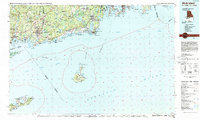
1984 Map of Block Island
USGS Topo · Published 1984About this map
Block Island and its primary settlement at New Shoreham anchor the southern reach of this coastal study, marking the nautical boundary where Block Island Sound meets the Atlantic Ocean. Along the mainland, the Amtrak rail line threads through historic shoreline communities from Mystic and Stonington in Connecticut across the Pawcatuck River into Westerly, Rhode Island. The map reveals a landscape defined by saltwater ponds and marshlands, including the extensive Great Swamp and Ninigret Pond, which separate the mainland interior from the barrier beaches. The interior reflects an era of established coastal conservation and military presence, evidenced by the Pequot Indian Res and numerous protected areas like the Ninigret National Wildlife Refuge. To the east, the mouth of Narragansett Bay is flanked by Jamestown and the dense streets of Newport, while to the southwest, the tip of Long Island reaches its terminus at Montauk Point and the Montauk Air Force Station.
Find a feature on this map
82 named features on this map. Tap any name to fly to it.
Don’t see what you’re looking for? This feature index may not catch every label — zoom into the map to look around manually.
Map Details
Editions of this 1984 Block Island Map
This is the sole edition of this map. No revisions or reprints were ever made.
Other maps of this area

1885 · New Bedford
USGS Topo · 1:62,500

1885 · Sakonnet
USGS Topo · 1:62,500

1888 · New Bedford
USGS Topo · 1:62,500

1888 · Fall River
USGS Topo · 1:62,500

1888 · Sakonnet
USGS Topo · 1:62,500

1889 · Stonington
USGS Topo · 1:62,500

1889 · Charlestown
USGS Topo · 1:62,500

1889 · Newport
USGS Topo · 1:62,500

1889 · Block Island
USGS Topo · 1:62,500

1889 · Moosup
USGS Topo · 1:62,500