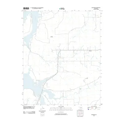
2010 Map of Blocker
USGS Topo · Published 2010About this map
Scaffold Mountain and Blue Mountain dominate the terrain of this Pittsburg County landscape, which is defined by the dendritic drainage patterns of the Eufaula Lake watershed. The intricate system of waterways includes the sprawling reaches of Mathuldy Creek to the west and the steady flow of Blue Creek and Jones Creek further south. The presence of the Oknoname 145002 Dam on the eastern edge indicates modern water management, while the rural road network, with routes like Sherrill's Rd and Jones Creek Rd, follows the natural contours of the ridges and valleys. This 2010 survey provides a high-resolution look at the rural character of the Blocker area, illustrating how the local infrastructure integrates with the prominent topography and the various creeks that feed into the larger regional basins.
Find a feature on this map
29 named features on this map. Tap any name to fly to it.
Don’t see what you’re looking for? This feature index may not catch every label — zoom into the map to look around manually.
Map Details
Editions of this 2010 Blocker Map
This is the sole edition of this map. No revisions or reprints were ever made.
Other maps of this area

1898 · McAlester
USGS Topo · 1:125,000

1900 · Sansbois
USGS Topo · 1:125,000

1900 · Canadian
USGS Topo · 1:125,000

1901 · Tuskahoma
USGS Topo · 1:125,000

1908 · Tuskahoma
USGS Topo · 1:125,000

1909 · Mc Alester
USGS Topo · 1:125,000

1909 · Tuskahoma
USGS Topo · 1:125,000

1909 · Sans Bois
USGS Topo · 1:125,000

1911 · Sansbois
USGS Topo · 1:125,000

1946 · Fort Smith
USGS Topo · 1:250,000