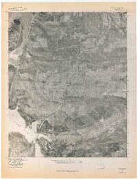
1977 Map of Blocker
USGS Topo · Published 1977About this map
Blocker sits at the center of this 1977 orthophotoquad, documenting a landscape defined by the intersection of high ridges and significant water bodies in Pittsburg County. The aerial photography captures the rugged interface between Scaffold Mountain to the north and Blue Mountain to the south, highlighting the varied topography of this Oklahoma region. The map provides a detailed visual record of the shoreline of Eufaula Lake, which cuts into the western and southern edges of the quadrangle. Local drainage patterns are clearly visible, including the winding course of Jones Creek as it moves through the valley between the peaks. Unlike traditional topographic maps, this orthophotograph uses rectified imagery to show the actual vegetation patterns and field boundaries of the late 1970s, offering a clear look at land use around the settlement of Blocker during this era.
Find a feature on this map
5 named features on this map. Tap any name to fly to it.
Don’t see what you’re looking for? This feature index may not catch every label — zoom into the map to look around manually.
Map Details
Editions of this 1977 Blocker Map
This is the sole edition of this map. No revisions or reprints were ever made.
Other maps of this area

1898 · McAlester
USGS Topo · 1:125,000

1900 · Sansbois
USGS Topo · 1:125,000

1900 · Canadian
USGS Topo · 1:125,000

1901 · Tuskahoma
USGS Topo · 1:125,000

1908 · Tuskahoma
USGS Topo · 1:125,000

1909 · Mc Alester
USGS Topo · 1:125,000

1909 · Tuskahoma
USGS Topo · 1:125,000

1909 · Sans Bois
USGS Topo · 1:125,000

1911 · Sansbois
USGS Topo · 1:125,000

1946 · Fort Smith
USGS Topo · 1:250,000