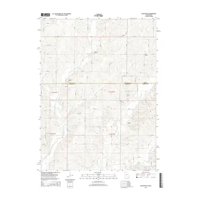
2014 Map of Blockton SE
USGS Topo · Published 2014About this map
The Middle Fork Grand River and E Fork Grand River carve through the agricultural landscape along the border of Iowa and Missouri. This 2014 survey captures the rural character of northern Worth County and southern Ringgold County, where the topography is defined by numerous drainage systems including Fiddlers Cr, Fletchall Cr, and Lotts Cr. For genealogists and local historians, the map is particularly useful for its documentation of family and community burial sites. Five distinct cemeteries are scattered across the landscape, including Middle Fork Cemetery, Hickory Grove Cemetery, Clark-Allen Cemetery, Crim Cemetery, and Douglas Cemetery. The map also depicts the local water management through Marlow Lake and the established network of county roads and trails like State Line Rd and 110th Rd that facilitate movement between these rural communities.
Find a feature on this map
39 named features on this map. Tap any name to fly to it.
Don’t see what you’re looking for? This feature index may not catch every label — zoom into the map to look around manually.
Map Details
Editions of this 2014 Blockton SE Map
This is the sole edition of this map. No revisions or reprints were ever made.
Other maps of this area

1940 · Blockton
USGS Topo · 1:62,500

1942 · Grant City
USGS Topo · 1:62,500

1943 · Grant City
USGS Topo · 1:62,500

1943 · Blockton
USGS Topo · 1:62,500

1945 · Mount Ayr
USGS Topo · 1:62,500

1947 · Mount Ayr
USGS Topo · 1:62,500

1948 · Bethany
USGS Topo · 1:62,500

1955 · Nebraska City
USGS Topo · 1:250,000

1957 · Nebraska City
USGS Topo · 1:250,000

1958 · Nebraska City
USGS Topo · 1:250,000