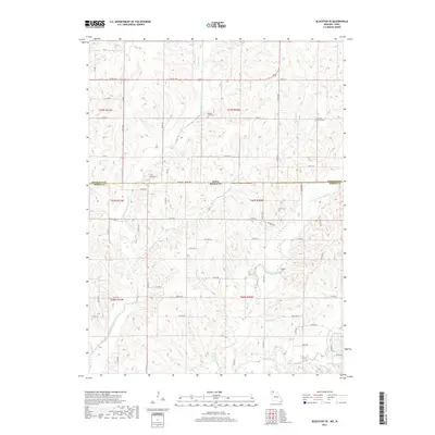
2017 Map of Blockton SE
USGS Topo · Published 2017About this map
The Middle Fork Grand River and E Fork Grand River carve through the landscape along the state line of Missouri and Iowa, defining the drainage patterns of northern Worth County. This 2017 survey details a rural region shaped by agricultural section lines and an extensive network of creeks, including Fletchall Cr and Fiddlers Cr. The map is particularly useful for genealogical research, as it identifies numerous family and community burial sites such as Middle Fork Cem, Hickory Grove Cem, and the Clark-Allen Cem.
Find a feature on this map
65 named features on this map. Tap any name to fly to it.
Don’t see what you’re looking for? This feature index may not catch every label — zoom into the map to look around manually.
Map Details
Editions of this 2017 Blockton SE Map
This is the sole edition of this map. No revisions or reprints were ever made.
Other maps of this area

1940 · Blockton
USGS Topo · 1:62,500

1942 · Grant City
USGS Topo · 1:62,500

1943 · Grant City
USGS Topo · 1:62,500

1943 · Blockton
USGS Topo · 1:62,500

1945 · Mount Ayr
USGS Topo · 1:62,500

1947 · Mount Ayr
USGS Topo · 1:62,500

1948 · Bethany
USGS Topo · 1:62,500

1955 · Nebraska City
USGS Topo · 1:250,000

1957 · Nebraska City
USGS Topo · 1:250,000

1958 · Nebraska City
USGS Topo · 1:250,000