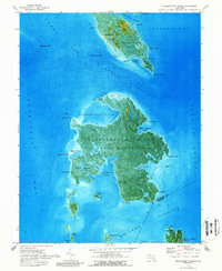
1973 Map of Bloodsworth Island
USGS Topo · Published 1988About this map
Bloodsworth Island dominates this 1970s orthophotomap, showing the marshy reaches of the Chesapeake's eastern shore before significant modern shoreline shifts. The island itself is designated as a U S Naval Reservation, a remote landscape defined by Piney Island Cove and Long Creek. To the north, the small community of Crocheron represents a rare pocket of permanent settlement on the mainland, supported by the Bethany Ch and a local Cem.
Find a feature on this map
63 named features on this map. Tap any name to fly to it.
Don’t see what you’re looking for? This feature index may not catch every label — zoom into the map to look around manually.
Map Details
Editions of this 1973 Bloodsworth Island Map
2 editions found
Other maps of this area

1898 · St. Marys
USGS Topo · 1:125,000

1903 · Nanticoke
USGS Topo · 1:62,500

1903 · Bloodsworth Island
USGS Topo · 1:62,500

1903 · Deal Island
USGS Topo · 1:62,500

1905 · Crapo
USGS Topo · 1:62,500

1906 · St. Marys
USGS Topo · 1:125,000

1942 · Terrapin Sand Point
USGS Topo · 1:24,000

1942 · Kedges Straits
USGS Topo · 1:24,000

1942 · Bloodsworth Island
USGS Topo · 1:24,000

1942 · Richland Point
USGS Topo · 1:24,000