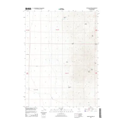
2015 Map of Bloody Run Peak
USGS Topo · Published 2015About this map
Bloody Run Peak dominates the high-elevation terrain of the Santa Rosa Range in this north-central Nevada survey. The landscape is defined by its dramatic verticality, as deep drainages like Pinson Canyon, Crossover Canyon, and Paiute Canyon carve through the mountains toward the alluvial flats below. The eastern portion of the map is occupied by the Bloody Run Hills, which separate the rugged interior from the broad expanse of the Silver State Valley to the west.
Find a feature on this map
21 named features on this map. Tap any name to fly to it.
Don’t see what you’re looking for? This feature index may not catch every label — zoom into the map to look around manually.
Map Details
Editions of this 2015 Bloody Run Peak Map
This is the sole edition of this map. No revisions or reprints were ever made.
Other maps of this area

1882 · Paradise
USGS Topo · 1:250,000

1893 · Paradise
USGS Topo · 1:250,000

1955 · McDermitt
USGS Topo · 1:250,000

1958 · Paradise Valley
USGS Topo · 1:62,500

1958 · Awakening Peak
USGS Topo · 1:62,500

1959 · McDermitt
USGS Topo · 1:250,000

1959 · Bliss
USGS Topo · 1:62,500
1981 · Barrett Springs
USGS Topo · 1:24,000
1982 · Silver State Draw
USGS Topo · 1:24,000
1982 · Awakening Peak
USGS Topo · 1:24,000