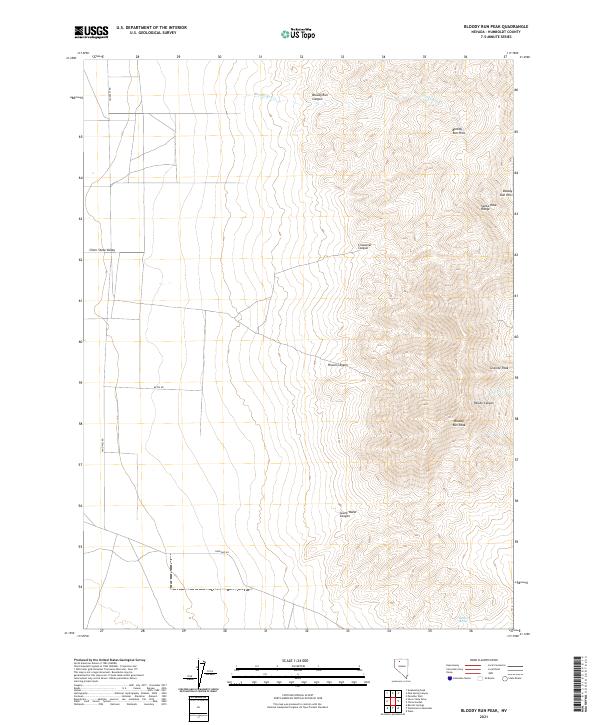
2021 Map of Bloody Run Peak
USGS Topo · Published 2021About this map
Bloody Run Peak rises as a dominant landmark in this portion of the Santa Rosa Range, defining a landscape of high summits and deep drainage systems in Humboldt County. The eastern slopes are carved by the dramatic Paiute Canyon and Pinson Canyon, while the western edge of the mountains gives way to the broad, flat expanse of the Silver State Valley. This high-desert terrain is marked by essential water sources like Bathtub Spring and the seasonal flow of Bloody Run Cr. Travel through the area is limited to established routes such as Sand Pass Rd and Betes Rd, which skirt the base of the Bloody Run Hills. The map captures the classic Basin and Range topography where steep canyons like Crossover Canyon and South Water Canyon provide the only natural passage through the mountain wall.
Find a feature on this map
21 named features on this map. Tap any name to fly to it.
Don’t see what you’re looking for? This feature index may not catch every label — zoom into the map to look around manually.
Map Details
Editions of this 2021 Bloody Run Peak Map
This is the sole edition of this map. No revisions or reprints were ever made.
Other maps of this area

1882 · Paradise
USGS Topo · 1:250,000

1893 · Paradise
USGS Topo · 1:250,000

1955 · McDermitt
USGS Topo · 1:250,000

1958 · Paradise Valley
USGS Topo · 1:62,500

1958 · Awakening Peak
USGS Topo · 1:62,500

1959 · McDermitt
USGS Topo · 1:250,000

1959 · Bliss
USGS Topo · 1:62,500
1981 · Barrett Springs
USGS Topo · 1:24,000
1982 · Silver State Draw
USGS Topo · 1:24,000
1982 · Awakening Peak
USGS Topo · 1:24,000