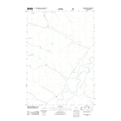
2011 Map of Bloom Creek
USGS Topo · Published 2011About this map
The Powder River meanders through this portion of Powder River County, carving a wide valley floor marked by several distinct tributaries and cattle country infrastructure. This 2011 survey highlights the region's reliance on water management in a semi-arid landscape, evidenced by a series of named catchments including Rimrock Reservoir, Bull Reservoir, Swope Reservoir, and Clay Reservoir. The presence of the Huckins School and the Three Bar Ranch indicates the scattered but established nature of local rural life.
Find a feature on this map
23 named features on this map. Tap any name to fly to it.
Don’t see what you’re looking for? This feature index may not catch every label — zoom into the map to look around manually.
Map Details
Editions of this 2011 Bloom Creek Map
This is the sole edition of this map. No revisions or reprints were ever made.
Other maps of this area

1954 · Ekalaka
USGS Topo · 1:250,000

1956 · Ekalaka
USGS Topo · 1:250,000

1958 · Ekalaka
USGS Topo · 1:250,000

1965 · Ekalaka
USGS Topo · 1:250,000

1966 · Phillips Butte
USGS Topo · 1:24,000

1966 · Hodsdon Flats
USGS Topo · 1:24,000

1970 · Moorhead
USGS Topo · 1:24,000

1970 · Bloom Creek
USGS Topo · 1:24,000

1970 · Huckins School
USGS Topo · 1:24,000
1970 · Sayle
USGS Topo · 1:24,000