
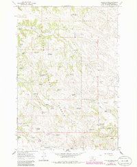
1966 Map of Phillips Butte
USGS Topo · Published 1969About this map
Custer National Forest encompasses a significant portion of this landscape, where the high plains of Powder River County meet a complex network of drainages and springs. The terrain is defined by prominent elevations such as Phillips Butte and Diamond Butte, which serve as landmarks in an area dominated by cattle ranching and resource management. The 1960s cattle-and-coal economy is evident in the proliferation of man-made water sources, including Elk Creek Reservoir No 4 and Lyon Creek Divide Reservoir, alongside natural features like Coal Mine Spring.
Find a feature on this map
44 named features on this map. Tap any name to fly to it.
Don’t see what you’re looking for? This feature index may not catch every label — zoom into the map to look around manually.
Map Details
Editions of this 1966 Phillips Butte Map
2 editions found
Other maps of this area

1954 · Hardin
USGS Topo · 1:250,000

1954 · Ekalaka
USGS Topo · 1:250,000

1956 · Ekalaka
USGS Topo · 1:250,000

1957 · Hardin
USGS Topo · 1:250,000

1958 · Ekalaka
USGS Topo · 1:250,000

1958 · Hardin
USGS Topo · 1:250,000

1965 · Ekalaka
USGS Topo · 1:250,000

1966 · Goodspeed Butte
USGS Topo · 1:24,000

1966 · Sonnette
USGS Topo · 1:24,000

1966 · Hodsdon Flats
USGS Topo · 1:24,000