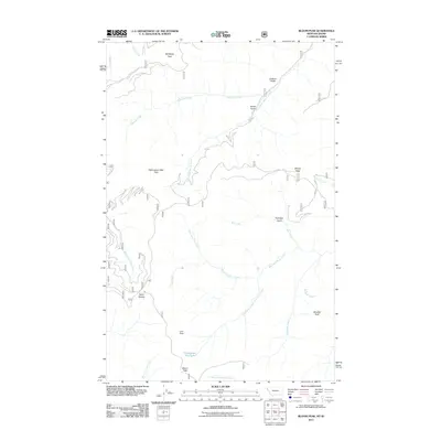
2011 Map of Bloom Peak
USGS Topo · Published 2011About this map
Bloom Peak and the surrounding high country of Shoshone County define this 2011 survey, where the drainage systems of the Idaho-Montana borderlands intersect. The terrain is marked by a series of prominent summits, including Mcneeley Peak in the north and the uniquely named Eightyseven Mile Peak further south. These peaks feed an intricate network of waterways such as Mcneeley Creek and South Fork Marten Creek, which carve deep through landforms like Sorrel Gulch and Jackson Gulch.
Find a feature on this map
25 named features on this map. Tap any name to fly to it.
Don’t see what you’re looking for? This feature index may not catch every label — zoom into the map to look around manually.
Map Details
Editions of this 2011 Bloom Peak Map
This is the sole edition of this map. No revisions or reprints were ever made.
Other maps of this area

1932 · Trout Creek
USGS Topo · 1:125,000

1935 · Trout Creek
USGS Topo · 1:125,000

1936 · Trout Creek
USGS Topo · 1:125,000

1956 · Cooper Gulch
USGS Topo · 1:62,500

1956 · Wallace
USGS Topo · 1:250,000

1957 · Burke
USGS Topo · 1:62,500

1960 · Wallace
USGS Topo · 1:250,000
1966 · Noxon Rapids Dam
USGS Topo · 1:24,000
1966 · Taylor Peak
USGS Topo · 1:24,000
1966 · Bloom Peak
USGS Topo · 1:24,000