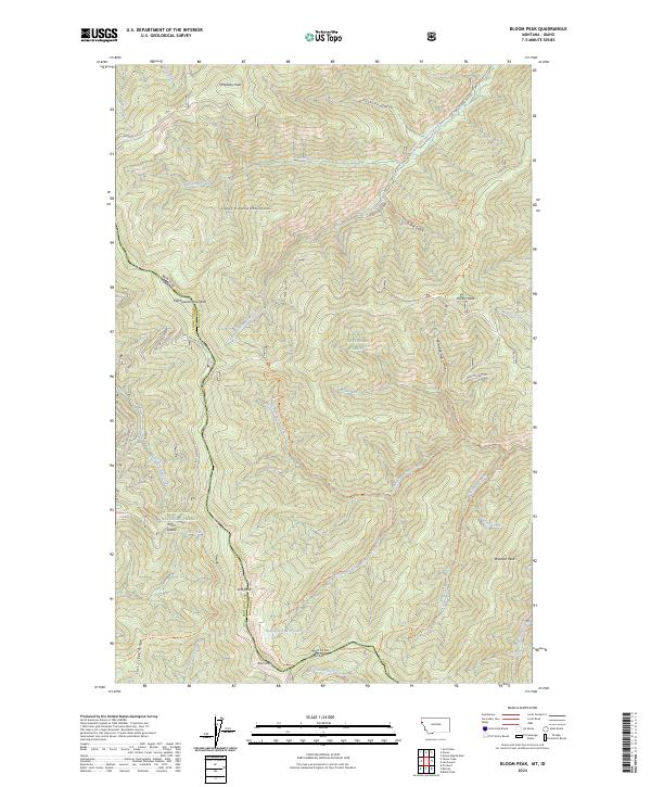
2024 Map of Bloom Peak
USGS Topo · Published 2024About this map
McNeeley Peak and Bloom Peak define the high ridgelines of this 2024 survey along the Bitterroot Range, where the state boundary separates Shoshone County, Idaho, from Sanders County, Montana. This high-altitude landscape is shared between the Kaniksu National Forest and Coeur d'Alene National Forest, featuring a complex network of drainage basins including Devil Run, Robin Run, and West Fork Trout Creek. Historical passage through these summits is marked by several established routes such as the State Line Trl and Trout Creek Nrt Trl. Notable landmarks like Taylor Saddle and the remote Ninetythree Mile Lake offer specific points of interest for those studying the topography of the Coeur d'Alene Mountains.
Find a feature on this map
69 named features on this map. Tap any name to fly to it.
Don’t see what you’re looking for? This feature index may not catch every label — zoom into the map to look around manually.
Map Details
Editions of this 2024 Bloom Peak Map
This is the sole edition of this map. No revisions or reprints were ever made.
Other maps of this area

1932 · Trout Creek
USGS Topo · 1:125,000

1935 · Trout Creek
USGS Topo · 1:125,000

1936 · Trout Creek
USGS Topo · 1:125,000

1956 · Cooper Gulch
USGS Topo · 1:62,500

1956 · Wallace
USGS Topo · 1:250,000

1957 · Burke
USGS Topo · 1:62,500

1960 · Wallace
USGS Topo · 1:250,000
1966 · Noxon Rapids Dam
USGS Topo · 1:24,000
1966 · Taylor Peak
USGS Topo · 1:24,000
1966 · Bloom Peak
USGS Topo · 1:24,000