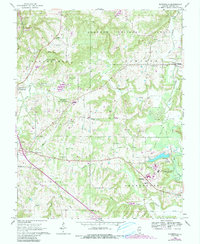
1966 Map of Bloomfield
USGS Topo · Published 1990About this map
Shawnee National Forest covers much of this landscape, where the interplay between state infrastructure and rural community life is clearly visible. The southeast quadrant is dominated by the Illinois State Prison (Vienna Branch), complete with its own State Prison Railroad and nearby Waterworks. The map preserves the locations of numerous family and community landmarks, such as Whiteside Cem and Harrett Cem, which are scattered among the ridges of Taylor Bluff and the drainage of McCorkle Creek. An Old Railroad Grade traces a path through the terrain, marking the evolution of local transport. Settlement patterns around Vienna, Simpson, and Grantsburg show a classic Southern Illinois mix of small-town centers and isolated country institutions like Concord Ch and Grantsburg Sch.
Find a feature on this map
54 named features on this map. Tap any name to fly to it.
Don’t see what you’re looking for? This feature index may not catch every label — zoom into the map to look around manually.
Map Details
Editions of this 1966 Bloomfield Map
3 editions found
Other maps of this area

1917 · Brownfield
USGS Topo · 1:62,500

1918 · Vienna
USGS Topo · 1:62,500

1919 · Vienna
USGS Topo · 1:62,500

1925 · Marion
USGS Topo · 1:62,500

1925 · Harrisburg
USGS Topo · 1:62,500

1939 · Harrisburg
USGS Topo · 1:62,500

1940 · Marion
USGS Topo · 1:62,500

1942 · Vienna
USGS Topo · 1:62,500

1949 · Paducah
USGS Topo · 1:250,000

1950 · Paducah
USGS Topo · 1:250,000