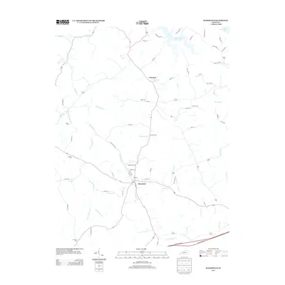
2013 Map of Bloomfield
USGS Topo · Published 2013About this map
Bloomfield serves as the primary hub in this Nelson County landscape, where the confluence of several branches of Simpson Creek dictates the layout of the town and surrounding farmland. The local geography is defined by a dendritic network of waterways including Simpson Cr, W Fork Simpson Cr, and E Fork Simpson Cr, which drain the undulating terrain toward Taylorsville Lake in the northeast. This 2013 topographic study reveals a rural community deeply rooted in its heritage, evidenced by numerous small family and community burial grounds such as Hunters Cem, Fairfield Cem, and Rogers Cem situated near the outlying settlement of Wakefield. The southern portion of the quadrangle is bisected by the modern transit corridor of Bluegrass Pkwy W, illustrating the intersection of historic settlement patterns with contemporary regional infrastructure.
Find a feature on this map
69 named features on this map. Tap any name to fly to it.
Don’t see what you’re looking for? This feature index may not catch every label — zoom into the map to look around manually.
Map Details
Editions of this 2013 Bloomfield Map
This is the sole edition of this map. No revisions or reprints were ever made.
Other maps of this area

1923 · Waddy
USGS Topo · 1:48,000

1925 · Mount Eden
USGS Topo · 1:48,000

1927 · Mount Eden
USGS Topo · 1:62,500

1929 · Taylorsville
USGS Topo · 1:62,500

1951 · Waterford
USGS Topo · 1:24,000

1952 · Chaplin
USGS Topo · 1:24,000

1953 · Brush Grove
USGS Topo · 1:24,000

1953 · Maud
USGS Topo · 1:24,000

1953 · Bardstown
USGS Topo · 1:24,000

1953 · Bloomfield
USGS Topo · 1:24,000