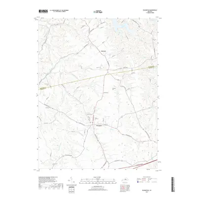
2019 Map of Bloomfield
USGS Topo · Published 2019About this map
Bloomfield serves as the primary hub in this portion of North-Central Kentucky, where a complex network of rural routes like Springfield Rd and Lawrenceburg Rd converge. The landscape is defined by the branching drainages of Simpson Creek and its various forks, which carved the terrain long before the modern addition of the Bluegrass Parkway to the south. Historically significant sites are scattered throughout the countryside, including Maple Grove Cem near the town center and more remote burial grounds like Wilkinson Cem and Ingram Cem. To the north, the waters of Taylorsville Lake reach into the valleys, contrasting with the smaller Wakefield Pond near the crossroads of Wakefield. This survey details a transition from the dense street grid of the village to the wide agricultural expanses surrounding Fairfield Hill.
Find a feature on this map
75 named features on this map. Tap any name to fly to it.
Don’t see what you’re looking for? This feature index may not catch every label — zoom into the map to look around manually.
Map Details
Editions of this 2019 Bloomfield Map
This is the sole edition of this map. No revisions or reprints were ever made.
Other maps of this area

1923 · Waddy
USGS Topo · 1:48,000

1925 · Mount Eden
USGS Topo · 1:48,000

1927 · Mount Eden
USGS Topo · 1:62,500

1929 · Taylorsville
USGS Topo · 1:62,500

1951 · Waterford
USGS Topo · 1:24,000

1952 · Chaplin
USGS Topo · 1:24,000

1953 · Brush Grove
USGS Topo · 1:24,000

1953 · Maud
USGS Topo · 1:24,000

1953 · Bardstown
USGS Topo · 1:24,000

1953 · Bloomfield
USGS Topo · 1:24,000