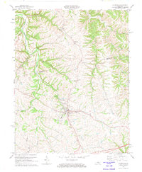
1972 Map of Bloomfield
USGS Topo · Published 1974About this map
Bloomfield serves as the primary hub of activity in this 1970s survey, situated along the rolling terrain of the Spencer Co Nelson Co boundary. The landscape is deeply etched by a network of waterways, including Simpson Run, Ashes Creek, and the Salt R in the northeast corner. This period reflects a transition in regional travel, with the modern Blue Grass Parkway cutting across the southern portion of the map while older settlements like Wakefield maintain their traditional character. Local history is well-preserved through numerous landmarks such as Maple Grove Cem, Ashes Creek Ch, and the Brown Jr High Sch. For those tracing family roots, the map provides precise locations for several burial grounds, including the Wilkinson Cem and Fairfield Cem, alongside small rural institutions like Big Springs Ch.
Find a feature on this map
26 named features on this map. Tap any name to fly to it.
Don’t see what you’re looking for? This feature index may not catch every label — zoom into the map to look around manually.
Map Details
Editions of this 1972 Bloomfield Map
2 editions found
Other maps of this area

1923 · Waddy
USGS Topo · 1:48,000

1925 · Mount Eden
USGS Topo · 1:48,000

1927 · Mount Eden
USGS Topo · 1:62,500

1929 · Taylorsville
USGS Topo · 1:62,500

1951 · Waterford
USGS Topo · 1:24,000

1952 · Chaplin
USGS Topo · 1:24,000

1953 · Brush Grove
USGS Topo · 1:24,000

1953 · Maud
USGS Topo · 1:24,000

1953 · Bardstown
USGS Topo · 1:24,000

1953 · Bloomfield
USGS Topo · 1:24,000