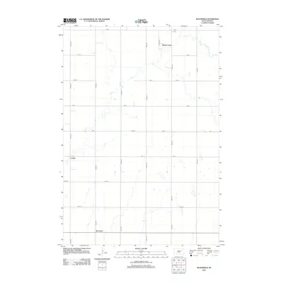
2012 Map of Bloomfield
USGS Topo · Published 2012About this map
Foster Cr meanders across this rural landscape in Spink County, defining the drainage patterns of a region dominated by a strict section-line road grid. The presence of the Hillside Colony in the northeastern portion of the map highlights the localized communal settlement patterns found in this part of South Dakota. Smaller historic centers such as LaDelle and Bloomfield are located along these grid lines, serving as focal points for the surrounding agricultural community. For those tracing family history or local land use, the Roe Cem is a significant genealogical landmark, situated near the northern boundary. The map provides a clear view of the transition from early prairie settlement to modern industrial-scale farming, as seen in the vast stretches of open land connected by routes like 408th Ave and 186th St.
Find a feature on this map
22 named features on this map. Tap any name to fly to it.
Don’t see what you’re looking for? This feature index may not catch every label — zoom into the map to look around manually.
Map Details
Editions of this 2012 Bloomfield Map
This is the sole edition of this map. No revisions or reprints were ever made.
Other maps of this area

1895 · Byron
USGS Topo · 1:125,000

1953 · Huron
USGS Topo · 1:250,000

1953 · Watertown
USGS Topo · 1:250,000

1954 · Huron
USGS Topo · 1:250,000

1956 · Lake Byron NW
USGS Topo · 1:24,000

1956 · Lake Byron
USGS Topo · 1:24,000

1956 · Doland SW
USGS Topo · 1:24,000

1956 · Lake Byron SE
USGS Topo · 1:24,000

1958 · Watertown
USGS Topo · 1:250,000
1971 · Doland SE
USGS Topo · 1:24,000