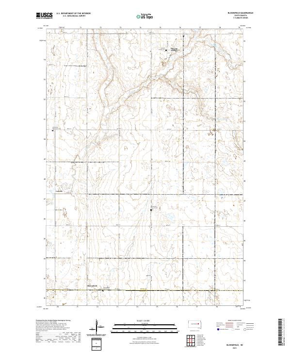
2021 Map of Bloomfield
USGS Topo · Published 2021About this map
The agricultural landscape of the Spink County and Beadle County border is defined by its small communal settlements and scattered rural cemeteries. The presence of Hillside Colony in the northern section, complete with the Hillside Colony Cem, reflects the region's Hutterite heritage. To the south, the settlement of Bloomfield anchors a network of section-line roads, including Co Rd 2, which divides the two counties. This area is a patchwork of prairie and wetlands, with the seasonal course of Foster Cr meandering through the western townships near LaDelle. Local history and genealogy are preserved in several distinct burial grounds, such as the Missionary Church Cem and the Emmanuel Mennonite Cem, which mark the spiritual centers of these early prairie communities.
Find a feature on this map
25 named features on this map. Tap any name to fly to it.
Don’t see what you’re looking for? This feature index may not catch every label — zoom into the map to look around manually.
Map Details
Editions of this 2021 Bloomfield Map
This is the sole edition of this map. No revisions or reprints were ever made.
Other maps of this area

1895 · Byron
USGS Topo · 1:125,000

1953 · Huron
USGS Topo · 1:250,000

1953 · Watertown
USGS Topo · 1:250,000

1954 · Huron
USGS Topo · 1:250,000

1956 · Lake Byron NW
USGS Topo · 1:24,000

1956 · Lake Byron
USGS Topo · 1:24,000

1956 · Doland SW
USGS Topo · 1:24,000

1956 · Lake Byron SE
USGS Topo · 1:24,000

1958 · Watertown
USGS Topo · 1:250,000
1971 · Doland SE
USGS Topo · 1:24,000