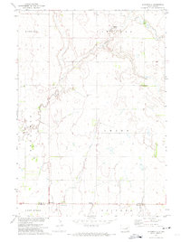
1971 Map of Bloomfield
USGS Topo · Published 1974About this map
The Spink and Beadle County line divides this 1970s landscape of the Missouri River Basin, where communal settlements and rural outposts are connected by a network of sectional roads. The northern portion is characterized by Hillside Colony, situated near the winding course of Foster Creek as it flows through Capitola and Harrison townships. The map records several vital community centers, including La Delle and the eponymous Bloomfield, as well as cultural landmarks like Emmanuel Ch and the Hutterthal Ch near the southern border. This period of development shows a reliance on local resources, evidenced by multiple Gravel Pits and a Gaging Station monitoring local waterways, providing a precise look at the agricultural and social organization of east-central South Dakota before modern consolidation.
Find a feature on this map
19 named features on this map. Tap any name to fly to it.
Don’t see what you’re looking for? This feature index may not catch every label — zoom into the map to look around manually.
Map Details
Editions of this 1971 Bloomfield Map
This is the sole edition of this map. No revisions or reprints were ever made.
Other maps of this area

1895 · Byron
USGS Topo · 1:125,000

1953 · Huron
USGS Topo · 1:250,000

1953 · Watertown
USGS Topo · 1:250,000

1954 · Huron
USGS Topo · 1:250,000

1956 · Lake Byron NW
USGS Topo · 1:24,000

1956 · Lake Byron
USGS Topo · 1:24,000

1956 · Doland SW
USGS Topo · 1:24,000

1956 · Lake Byron SE
USGS Topo · 1:24,000

1958 · Watertown
USGS Topo · 1:250,000
1971 · Doland SE
USGS Topo · 1:24,000
Featured Places
- Union Township, SD
- Capitola Township, SD
- Harrison Township, SD
- Bloomfield, SD
- Hillside Hutterite Colony, SD