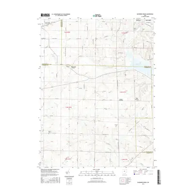
2016 Map of Blooming Grove
USGS Topo · Published 2016About this map
Blooming Grove sits at the intersection of Morrow, Richland, and Crawford counties, serving as a quiet focal point in a landscape defined by headwater tributaries and family cemeteries. This 2016 survey shows the transition from the Olentangy River drainage in the west toward the Clear Fork Reservoir in the east. The map provides significant genealogical value, documenting numerous burial grounds such as Red Squirrel Cem, Haldeman Cem, and the Peace Reformed Cem near the Crawford County line.
Find a feature on this map
126 named features on this map. Tap any name to fly to it.
Don’t see what you’re looking for? This feature index may not catch every label — zoom into the map to look around manually.
Map Details
Editions of this 2016 Blooming Grove Map
This is the sole edition of this map. No revisions or reprints were ever made.
Other maps of this area

1913 · Mount Gilead
USGS Topo · 1:62,500

1915 · Bucyrus
USGS Topo · 1:62,500

1915 · Crestline
USGS Topo · 1:62,500

1915 · Shauck
USGS Topo · 1:62,500

1916 · Mount Gilead
USGS Topo · 1:62,500

1943 · Shauck
USGS Topo · 1:62,500

1943 · Bucyrus
USGS Topo · 1:62,500

1943 · Crestline
USGS Topo · 1:62,500

1943 · Mount Gilead
USGS Topo · 1:62,500

1950 · Marion
USGS Topo · 1:250,000