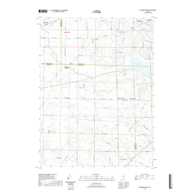
2019 Map of Blooming Grove
USGS Topo · Published 2019About this map
The Olentangy River and Clear Fork Reservoir anchor the landscape of this rural region where Crawford, Richland, and Morrow counties meet. A dense network of local roads connect small, historic crossroads like Steam Corners and Jugs Corners, while larger municipal edges like Galion and Ontario appear in the northern corners. The map preserves a wealth of genealogical landmarks, including a high concentration of burial sites such as the Red Squirrel Cem and Haldeman Cem. The intersection of drainage basins is evident here, with the Rocky Fork and Cedar Fork flowing through the undulating terrain near Pleasant Hill. This 2019 survey documents the contemporary land patterns and residential development along corridors like Marion Avenue Rd and Millsboro Rd.
Find a feature on this map
91 named features on this map. Tap any name to fly to it.
Don’t see what you’re looking for? This feature index may not catch every label — zoom into the map to look around manually.
Map Details
Editions of this 2019 Blooming Grove Map
This is the sole edition of this map. No revisions or reprints were ever made.
Other maps of this area

1913 · Mount Gilead
USGS Topo · 1:62,500

1915 · Bucyrus
USGS Topo · 1:62,500

1915 · Crestline
USGS Topo · 1:62,500

1915 · Shauck
USGS Topo · 1:62,500

1916 · Mount Gilead
USGS Topo · 1:62,500

1943 · Shauck
USGS Topo · 1:62,500

1943 · Bucyrus
USGS Topo · 1:62,500

1943 · Crestline
USGS Topo · 1:62,500

1943 · Mount Gilead
USGS Topo · 1:62,500

1950 · Marion
USGS Topo · 1:250,000