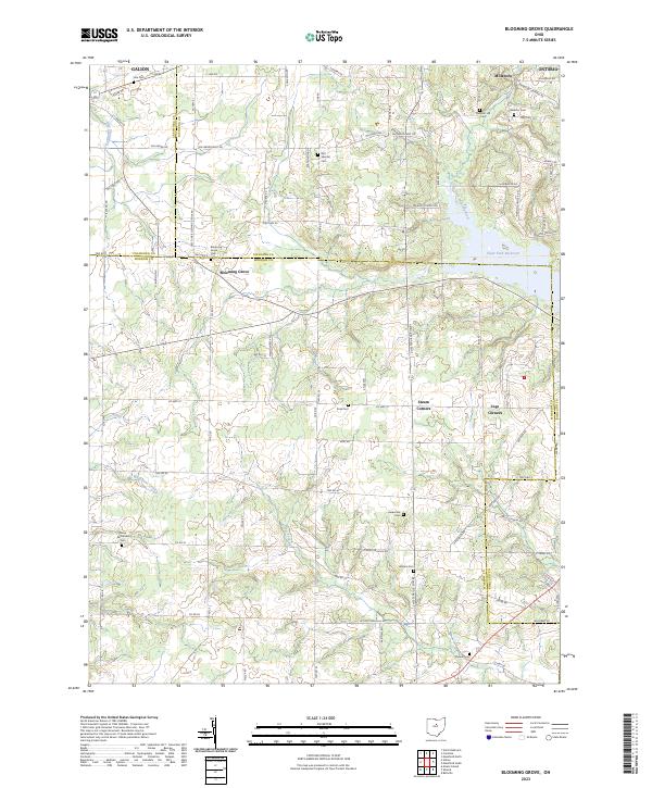
2023 Map of Blooming Grove
USGS Topo · Published 2023About this map
Blooming Grove sits at the heart of this North-Central Ohio landscape, where the rural boundaries of Morrow, Richland, and Crawford counties meet. The area is defined by its historical rural cemeteries and small crossroads settlements that have anchored local families for generations. To the east, the Clear Fork Reservoir and the Clear Fork Mohican River dominate the topography, while smaller waterways like Whetstone Creek and Rocky Fork carve through the western farmland.
Find a feature on this map
90 named features on this map. Tap any name to fly to it.
Don’t see what you’re looking for? This feature index may not catch every label — zoom into the map to look around manually.
Map Details
Editions of this 2023 Blooming Grove Map
This is the sole edition of this map. No revisions or reprints were ever made.
Other maps of this area

1913 · Mount Gilead
USGS Topo · 1:62,500

1915 · Bucyrus
USGS Topo · 1:62,500

1915 · Crestline
USGS Topo · 1:62,500

1915 · Shauck
USGS Topo · 1:62,500

1916 · Mount Gilead
USGS Topo · 1:62,500

1943 · Shauck
USGS Topo · 1:62,500

1943 · Bucyrus
USGS Topo · 1:62,500

1943 · Crestline
USGS Topo · 1:62,500

1943 · Mount Gilead
USGS Topo · 1:62,500

1950 · Marion
USGS Topo · 1:250,000