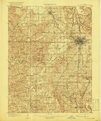
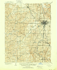
1910 Map of Bloomington
USGS Topo · Published 1919About this map
Bloomington serves as the focal point of this 1910 survey, showing the city's early street grid and its connection to the Indiana University campus before the major expansions of the mid-20th century. The landscape is defined by a dense network of rural infrastructure, including a remarkable number of named schoolhouses like Hordscrabble School and Waterworks School, alongside small outlying settlements such as Ellettsville and Channellsville. The rail-dominated economy of Monroe County is evident through the convergence of the Chicago Indianapolis and Louisville RR and the Illinois Central RR. South of the city, smaller industrial or freight-related stops like Anne Switch and Diamond Valley Switch point to the local importance of stone quarrying and agricultural transport. The map also delineates the precise boundaries between Monroe and Owen counties, highlighting the transition from urban center to the rugged, stream-cut hills of the Clear Creek and Indian Creek drainages.
Find a feature on this map
102 named features on this map. Tap any name to fly to it.
Don’t see what you’re looking for? This feature index may not catch every label — zoom into the map to look around manually.
Map Details
Editions of this 1910 Bloomington Map
6 editions found
Other maps of this area

1908 · Bloomington
USGS Topo · 1:48,000

1908 · Bloomfield
USGS Topo · 1:62,500

1910 · Bloomington
USGS Topo · 1:62,500

1934 · Bedford
USGS Topo · 1:48,000

1935 · Oolitic
USGS Topo · 1:48,000

1937 · Bedford
USGS Topo · 1:62,500

1942 · Franklin
USGS Topo · 1:125,000

1942 · Oolitic
USGS Topo · 1:62,500

1947 · Allens Creek
USGS Topo · 1:24,000

1947 · Unionville
USGS Topo · 1:24,000