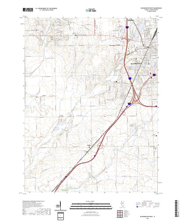
2024 Map of Bloomington West
USGS Topo · Published 2024About this map
The suburban edge of Bloomington and Normal meets the agricultural expanse of McLean County in this contemporary survey. The landscape is defined by the transition from dense residential grids to open farmland, anchored by smaller outlying settlements like Shirley, Covell, and Twin Grove. Waterways such as Sugar Creek and Timber Creek meander across the prairie, while major transport corridors, including the N Mitsubishi Mtwy, facilitate the movement of commerce and people. For local historians, the concentration of burial grounds is significant, ranging from the County Farm Cem to the Jewish Cem and Saint Mary's Cem. A notable localized landmark is the Cottonwood Airport, illustrating the integration of private aviation into the rural-suburban fringe. The map captures the current footprint of these communities, reflecting how modern development continues to reshape the central Illinois prairie.
Find a feature on this map
145 named features on this map. Tap any name to fly to it.
Don’t see what you’re looking for? This feature index may not catch every label — zoom into the map to look around manually.
Map Details
Editions of this 2024 Bloomington West Map
This is the sole edition of this map. No revisions or reprints were ever made.
Other maps of this area

1926 · Normal
USGS Topo · 1:62,500

1927 · Danvers
USGS Topo · 1:62,500

1930 · Danvers
USGS Topo · 1:62,500

1930 · Normal
USGS Topo · 1:62,500

1949 · Mc Lean
USGS Topo · 1:62,500

1951 · McLean
USGS Topo · 1:62,500

1951 · Le Roy
USGS Topo · 1:62,500

1958 · Peoria
USGS Topo · 1:250,000

1961 · Peoria
USGS Topo · 1:250,000

1963 · Peoria
USGS Topo · 1:250,000