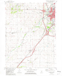
1981 Map of Bloomington West
USGS Topo · Published 1981About this map
Bloomington and Normal anchor the northeast corner of this 1981 survey, where the burgeoning urban grid meets the agricultural expanse of McLean County. The map documents a critical period of infrastructure growth, notably the interchange of the Illinois Central Gulf and Norfolk and Western railroads alongside major highway developments. Beyond the city limits, the landscape is defined by traditional township boundaries like Dale and Dry Grove, where smaller communities such as Shirley and Covell maintain their identity amidst the rolling fields.
Find a feature on this map
42 named features on this map. Tap any name to fly to it.
Don’t see what you’re looking for? This feature index may not catch every label — zoom into the map to look around manually.
Map Details
Editions of this 1981 Bloomington West Map
This is the sole edition of this map. No revisions or reprints were ever made.
Other maps of this area

1926 · Normal
USGS Topo · 1:62,500

1927 · Danvers
USGS Topo · 1:62,500

1930 · Danvers
USGS Topo · 1:62,500

1930 · Normal
USGS Topo · 1:62,500

1949 · Mc Lean
USGS Topo · 1:62,500

1951 · McLean
USGS Topo · 1:62,500

1951 · Le Roy
USGS Topo · 1:62,500

1958 · Peoria
USGS Topo · 1:250,000

1961 · Peoria
USGS Topo · 1:250,000

1963 · Peoria
USGS Topo · 1:250,000