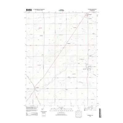
2013 Map of Bloomville
USGS Topo · Published 2013About this map
Bloomville and Republic anchor this portion of Seneca County, connected by the diagonal corridor of State Route 67 as it cuts across the township lines. The landscape is defined by the headwaters and tributaries of several prominent waterways, including Honey Creek, Silver Creek, and Rock Creek, which drain the agricultural plains of north-central Ohio. The density of community burial grounds, such as Farewell Retreat Cemetery and Scipio Township Cemetery, provides a clear map of the early rural settlements and family lineages that established themselves here. Small railway junctions and stopping points like Swander and Rockaway illustrate the historic transit network that supported the local farm economy, while the grid of township roads reveals the organized expansion of the region during the nineteenth and early twentieth centuries.
Find a feature on this map
96 named features on this map. Tap any name to fly to it.
Don’t see what you’re looking for? This feature index may not catch every label — zoom into the map to look around manually.
Map Details
Editions of this 2013 Bloomville Map
This is the sole edition of this map. No revisions or reprints were ever made.
Other maps of this area

1906 · Sycamore
USGS Topo · 1:62,500

1906 · Tiffin
USGS Topo · 1:62,500

1915 · Siam
USGS Topo · 1:62,500

1915 · Bucyrus
USGS Topo · 1:62,500

1943 · Bucyrus
USGS Topo · 1:62,500

1950 · Marion
USGS Topo · 1:250,000

1956 · Toledo
USGS Topo · 1:250,000

1960 · Sycamore
USGS Topo · 1:24,000
1960 · Watson
USGS Topo · 1:24,000

1960 · Tiffin South
USGS Topo · 1:24,000