
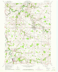
1960 Map of Sycamore
USGS Topo · Published 1961About this map
The Old Indian Treaty Boundary slices diagonally across this 1960 landscape, a permanent mark of earlier frontiers within Wyandot and Seneca Counties. Agricultural life centers on the village of Sycamore at the junction of the Akron Canton and Youngtown and New York Central railroads. These rail lines define the movement of goods through small settlements like Belle Vernon and Deunquat, while the Sandusky River meanders through the western reaches, passing Smithville and the Parker Bridge.
Find a feature on this map
40 named features on this map. Tap any name to fly to it.
Don’t see what you’re looking for? This feature index may not catch every label — zoom into the map to look around manually.
Map Details
Editions of this 1960 Sycamore Map
Other maps of this area

1901 · Fostoria
USGS Topo · 1:62,500

1903 · Fostoria
USGS Topo · 1:62,500

1906 · Sycamore
USGS Topo · 1:62,500

1906 · Tiffin
USGS Topo · 1:62,500

1907 · Upper Sandusky
USGS Topo · 1:62,500

1950 · Marion
USGS Topo · 1:250,000

1956 · Toledo
USGS Topo · 1:250,000

1960 · Tiffin South
USGS Topo · 1:24,000

1960 · Oceola
USGS Topo · 1:24,000
1960 · Bloomville
USGS Topo · 1:24,000