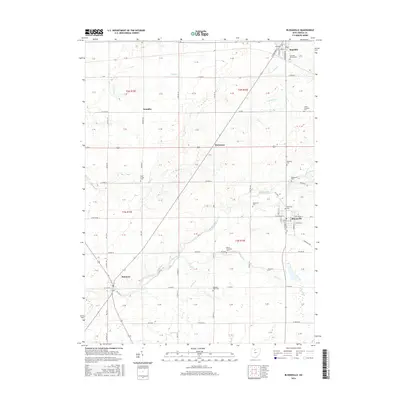
2016 Map of Bloomville
USGS Topo · Published 2016About this map
Bloomville and the surrounding agricultural landscapes of Seneca County are defined by a network of drainage ditches and small creeks that supported local farming for generations. The village of Bloomville itself is mapped in detail, showing the street grid near College St and S Prospect St. To the north, the community of Republic sits near the intersection of several county roads, while smaller hamlets like Swander and Rockaway mark the transition through the township lands.
Find a feature on this map
69 named features on this map. Tap any name to fly to it.
Don’t see what you’re looking for? This feature index may not catch every label — zoom into the map to look around manually.
Map Details
Editions of this 2016 Bloomville Map
This is the sole edition of this map. No revisions or reprints were ever made.
Other maps of this area

1906 · Sycamore
USGS Topo · 1:62,500

1906 · Tiffin
USGS Topo · 1:62,500

1915 · Siam
USGS Topo · 1:62,500

1915 · Bucyrus
USGS Topo · 1:62,500

1943 · Bucyrus
USGS Topo · 1:62,500

1950 · Marion
USGS Topo · 1:250,000

1956 · Toledo
USGS Topo · 1:250,000

1960 · Sycamore
USGS Topo · 1:24,000
1960 · Watson
USGS Topo · 1:24,000

1960 · Tiffin South
USGS Topo · 1:24,000