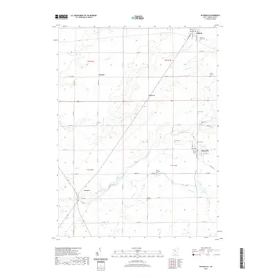
2019 Map of Bloomville
USGS Topo · Published 2019About this map
Bloomville and Republic anchor this portion of Seneca County, connected by a network of rural roads that trace the agricultural character of Northwest Ohio. The landscape is defined by the subtle drainage of Honey Creek and the Silver Creek system, which meander through a grid of townships. Evidence of early settlement is widespread, particularly through a high density of family and community burial grounds such as Farewell Retreat Cem and Dunkard Cem. The map illustrates how small hamlets like Swander, Rockaway, and Melmore persisted as local hubs into the 21st century. The surveying provides clear detail for researchers looking to pinpoint historic property lines and township divisions within t1n r16e and t2n r15e, offering a precise record of the regional hydrology including Slee Ditch and the upper reaches of Rock Cr.
Find a feature on this map
69 named features on this map. Tap any name to fly to it.
Don’t see what you’re looking for? This feature index may not catch every label — zoom into the map to look around manually.
Map Details
Editions of this 2019 Bloomville Map
This is the sole edition of this map. No revisions or reprints were ever made.
Other maps of this area

1906 · Sycamore
USGS Topo · 1:62,500

1906 · Tiffin
USGS Topo · 1:62,500

1915 · Siam
USGS Topo · 1:62,500

1915 · Bucyrus
USGS Topo · 1:62,500

1943 · Bucyrus
USGS Topo · 1:62,500

1950 · Marion
USGS Topo · 1:250,000

1956 · Toledo
USGS Topo · 1:250,000

1960 · Sycamore
USGS Topo · 1:24,000
1960 · Watson
USGS Topo · 1:24,000

1960 · Tiffin South
USGS Topo · 1:24,000