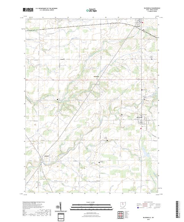
2023 Map of Bloomville
USGS Topo · Published 2023About this map
Bloomville and the surrounding township lands in Seneca County are defined by a network of rural crossroads and persistent family cemeteries. This 2023 survey records the settled landscape where Honey Creek and its tributaries, including Silver Creek and Rock Creek, drain the agricultural plains of north-central Ohio. The village of Republic sits at the northern edge of this map, connected by a grid of township and county roads to smaller locales such as Melmore and Swander.
Find a feature on this map
64 named features on this map. Tap any name to fly to it.
Don’t see what you’re looking for? This feature index may not catch every label — zoom into the map to look around manually.
Map Details
Editions of this 2023 Bloomville Map
This is the sole edition of this map. No revisions or reprints were ever made.
Other maps of this area

1906 · Sycamore
USGS Topo · 1:62,500

1906 · Tiffin
USGS Topo · 1:62,500

1915 · Siam
USGS Topo · 1:62,500

1915 · Bucyrus
USGS Topo · 1:62,500

1943 · Bucyrus
USGS Topo · 1:62,500

1950 · Marion
USGS Topo · 1:250,000

1956 · Toledo
USGS Topo · 1:250,000

1960 · Sycamore
USGS Topo · 1:24,000
1960 · Watson
USGS Topo · 1:24,000

1960 · Tiffin South
USGS Topo · 1:24,000