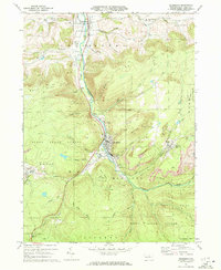
1970 Map of Blossburg
USGS Topo · Published 1972About this map
The industrial and natural landscape of Tioga County is sharply defined in this 1970s study, where the Tioga River valley serves as a corridor for the Erie Lackawanna railroad and the borough of Blossburg. The map documents a transition in resource extraction, showing numerous Strip Mine operations carved into the hillsides of Tioga State Forest, particularly around the mining settlements of Arnot and Morris Run. These smaller villages, along with Covington to the north, maintain their distinct identities through local landmarks like St Marys Ch and St Andrews Ch. This period shows the coexistence of heavy industry with the recreational spaces of Roadside Park and the high ridges of Maple Hill and Huckleberry Mtn. Genealogists will find significant value in the documentation of remote burial grounds such as Frost Settlement Cem and Gray Cem, which anchor the area's pioneer history amidst the evolving mid-century economy.
Find a feature on this map
49 named features on this map. Tap any name to fly to it.
Don’t see what you’re looking for? This feature index may not catch every label — zoom into the map to look around manually.
Map Details
Editions of this 1970 Blossburg Map
4 editions found
Other maps of this area

1900 · Tioga
USGS Topo · 1:62,500

1902 · Tioga
USGS Topo · 1:62,500

1925 · Blossburg
USGS Topo · 1:62,500

1927 · Blossburg
USGS Topo · 1:62,500

1931 · Troy
USGS Topo · 1:48,000

1938 · Troy
USGS Topo · 1:62,500

1942 · Canton
USGS Topo · 1:62,500

1944 · Blossburg
USGS Topo · 1:62,500

1944 · Canton
USGS Topo · 1:62,500

1953 · Roseville
USGS Topo · 1:24,000