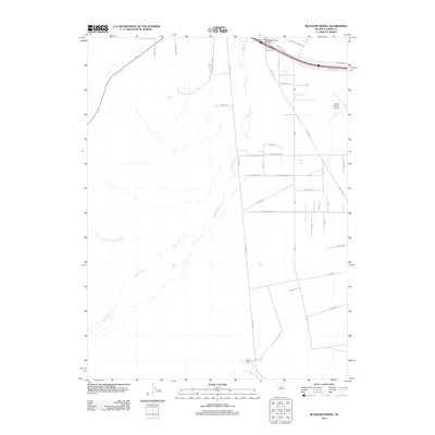
2012 Map of Blossom Spring
USGS Topo · Published 2012About this map
The braided course of the Reese River dominates this Lander County landscape, cutting a wide, shifting path through the valley floor. To the north, the East Battle Mountain Interchange and the Lander County Airport signal the region's modern logistical importance, connected by roads such as Muleshoe Rd and Industrial Way. Despite this infrastructure, the map reveals a sparsely populated interior where small settlements and agricultural sites like Madison and Marvel Ranch hold their ground. The naming of Blossom Spring and seasonal waterways like Little Cottonwood Creek highlight the critical role of water sources in this arid Nevada basin. A systematic grid of residential planning appears near the airport, with streets named for presidents including James Monroe and Millard Fillmore Ave, suggesting a pocket of concentrated development amidst the wide-open valley.
Find a feature on this map
27 named features on this map. Tap any name to fly to it.
Don’t see what you’re looking for? This feature index may not catch every label — zoom into the map to look around manually.
Map Details
Editions of this 2012 Blossom Spring Map
This is the sole edition of this map. No revisions or reprints were ever made.
Other maps of this area

1932 · Sonoma Range
USGS Topo · 1:250,000

1939 · Sonoma Range
USGS Topo · 1:250,000

1940 · Antler Peak
USGS Topo · 1:62,500

1943 · Antler Peak
USGS Topo · 1:62,500

1949 · Mt. Lewis
USGS Topo · 1:62,500

1950 · Mt. Lewis
USGS Topo · 1:62,500

1955 · Winnemucca
USGS Topo · 1:250,000

1957 · Battle Mountain
USGS Topo · 1:62,500

1958 · Winnemucca
USGS Topo · 1:250,000

1961 · McCoy
USGS Topo · 1:62,500