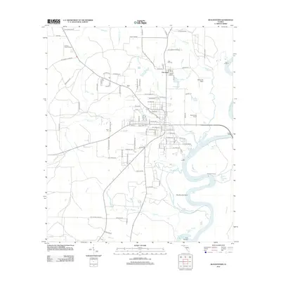
2012 Map of Blountstown
USGS Topo · Published 2012About this map
The Apalachicola River winds through the eastern side of this Florida landscape, defining a complex system of backwaters and oxbow lakes such as Sheppard Lake, Blue Lake, and Gin House Lake. This 2012 survey illustrates the connectivity between the river and the surrounding rural infrastructure, where landings like Neal Landing and Sheppards Landing denote historically significant access points along the water. The settlement pattern is characterized by family-named roads and rural clusters, including the community of Pine Island. Local history is anchored by several documented burial grounds, including Nettle Ridge Cem and Wood Cem, while the presence of both the Calhoun County Airport and the Blountstown Airport suggests the area's role as a regional transportation hub for Calhoun County. The terrain transitions from the elevated Peach Tree Ridge down to the low-lying West Wynnton Bend, providing a clear view of the drainage patterns of Stafford Cr and Sutton Cr as they feed the river system.
Find a feature on this map
109 named features on this map. Tap any name to fly to it.
Don’t see what you’re looking for? This feature index may not catch every label — zoom into the map to look around manually.
Map Details
Editions of this 2012 Blountstown Map
This is the sole edition of this map. No revisions or reprints were ever made.
Other maps of this area

1944 · Clarksville
USGS Topo · 1:31,680

1945 · Blountstown
USGS Topo · 1:31,680

1945 · Clarksville
USGS Topo · 1:31,680

1945 · Estiffanulga
USGS Topo · 1:31,680

1945 · Bristol
USGS Topo · 1:31,680

1945 · Frink
USGS Topo · 1:31,680

1945 · Woods
USGS Topo · 1:31,680

1952 · Altha West
USGS Topo · 1:24,000

1952 · Altha East
USGS Topo · 1:24,000

1954 · Tallahassee
USGS Topo · 1:250,000